Funding from the Canada Water Agency is enabling a University of Winnipeg research team to produce a targeted map of phosphorus runoff hotspots in the Red River basin during Manitoba’s annual snowmelt, with the aim to keep more of the nutrient in farmers’ fields and out of Lake Winnipeg.
The team, led by soil scientist Dr. Darshani Kumaragamage, Professor in the Department of Environmental Studies and Sciences (EES), is receiving $218,000 over three years through the Lake Winnipeg Basin Program to improve understandings of phosphorous runoff in snowmelt and how to reduce it.
The Hon. Julie Dabrusin, Canada’s Minister of Environment and Climate Change, announced the funding on October 18 as part of a $1.6-million overall investment in 10 projects and organizations that support the health of Lake Winnipeg, a body of water integral to Manitoba First Nation and Métis communities, anglers, farmers, cottagers, and beachgoers.
Along with the creation of the runoff map, which will be put online for researchers, stakeholders, and farmers to access, the UWinnipeg team will also test several blended soil amendments to see if they improve phosphorus retention in farmers’ fields.
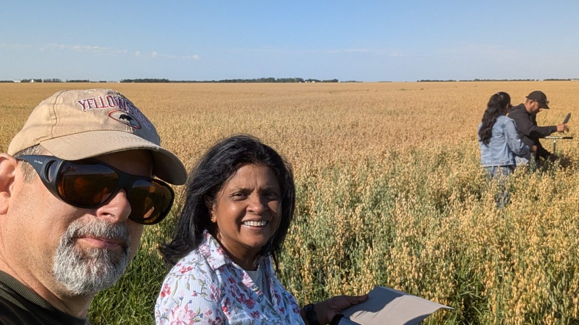
This fall, Dr. Kumaragamage and her team, which includes Dr. Nora Casson (Geography), Dr. Doug Goltz (Chemistry), and Dr. Srimathie Indraratne (EES), were busy collecting over 100 soil samples from fields located from Winnipeg to Emerson and from Steinbach to Carman.
“We were amazed by the response from farmers,” Dr. Kumaragamage said. “They were so happy for us to get to their fields and take samples.”
In some locations, the team also installed snowmelt collectors to monitor spring runoff.
“One thing we found from our previous research is that the phosphorus that gets into snowmelt runoff varies a lot from place to place in this region,” Dr. Kumaragamage said.
Soil types vary in their capacity to store and release phosphorus.
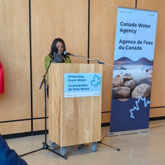
Dr. Kumaragamage speaks at the federal funding announcement on October 18.
“Some soils have fairly high phosphorus levels, but keep it in the soil without letting it go,” Dr. Kumaragamage explained. “These are the types of things that we need to understand better.”
When the project is complete, it will give future scientists studying Lake Winnipeg a fuller and more accurate picture of phosphorus runoff during snowmelt. That data will be crucial to solutions going forward.
“The map we will produce will give us an idea of where most of the phosphorus is coming from so that we can deploy more targeted management options to reduce the amount of phosphorus loss,” Dr. Kumaragamage said.
Project collaborators include Agriculture and Agri-Food Canada, Manitoba Environment and Climate Change, the University of Manitoba, and local watershed districts. The Lake Winnipeg Foundation is also contributing funding to the project.
Localizing solutions
Dr. Kumaragamage has been studying phosphorus at UWinnipeg since 2009. Her earlier research focused on fertilizer management and crop yields.
“More recently, my focus has been on managing phosphorus in the field better so that it stays on the land, where it benefits crops, and out of lakes, where it causes harm,” she said. “I think if we can do that, it’s a win-win.”
On the Prairies, snowmelt is the main way phosphorus gets into lakes and the rivers that feed them.
“In most other places in the world, it is erosion, not snowmelt, that carries soil particles containing phosphorus to the waterways,” Dr. Kumaragamage said.
That means solutions designed in tropical and temperate parts of the globe don’t work so well here.
“Most of them are focused on reducing either erosion losses or rain-driven runoff losses. Very few are addressing the snowmelt runoff,” she said.
A very important lake
Lake Winnipeg is Canada’s sixth-largest lake and the 11th-largest freshwater lake in the world. The phosphorus map will focus on Manitoba’s portion of Lake Winnipeg’s huge drainage basin, which spans over one million square kilometres and touches four Canadian provinces and four U.S. states. The Lake Winnipeg drainage basin is a hub of economic activity, hosting 70 per cent of Canada’s farmland, 62 per cent of Canada’s cattle population, and 40 per cent of Canada’s hog population, according to the federal government.
It also accounts for over one quarter of Canada’s freshwater fishery revenue and over $600 million worth of hydroelectric generation annually. For many First Nations and Métis communities, it also holds deep cultural and spiritual significance.
Lake Winnipeg has been impacted by climate change, nutrient loading, algal blooms, and invasive species like zebra mussels. Improving its water quality and ecosystem health, while supporting local farmers to grow food more sustainably, is a priority for Ottawa.
From mapping to testing
The UWinnipeg team will also test soil amendments, which are substances applied to improve soil conditions. Manitoba soils are naturally alkaline, so the team is experimenting with gypsum, Epsom salts, alum, and ferric chloride.
“They have some kind of ability to keep the phosphorus on the land because they react with phosphorus and improve the retention of phosphorus in the soil,” Dr. Kumaragamage explained. “So the phosphorus will be available to the plant slowly, over a longer period of time, and loss will be reduced.”
Dr. Kumaragamage said she thankful for the Canada Water Agency’s support, adding none of the research would be possible without farmers.
“I love talking with farmers. We got an amazing response. They just opened their fields to our team.”