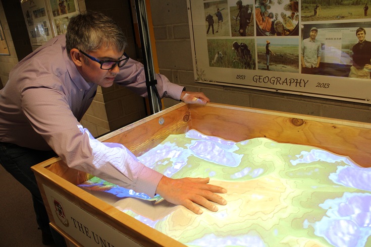
Dr. Christopher Storie demonstrates how UWinnipeg’s new AR sandbox can help students translate technical, scientific language into well-rounded knowledge that inspires creativity.
“This isn’t the geography your parents studied,” said Department of Geography Chair, Dr. Christopher Storie, as he showed off The University of Winnipeg’s new augmented reality (AR) virtual sandbox.
The AR virtual sandbox uses 3D visualization applications to demonstrate geographic concepts while allowing users to physically shape and contour sand into a topographic model overlaid by the projection of an elevation colour map, contour lines, and simulated water.
“It’s a powerful visual aide and a lot of people connect with it because it has this tangible quality you can play with,” said Storie. “The camera is designed to look at the surface in three dimensions. It reads the surface of the sand, the peaks and valleys, bumps, and divots. Then the computer processes that and projects what most people would interpret as a topographic map.”
The Department of Geography had been interested in building an AR sandbox since it was first developed by researchers at UC Davis’ W.M. Keck Center for Active Visualization in the Earth Sciences (KeckCAVES), but other projects took up time and resources, leaving the idea on the back burner.
Storie was thrilled when Loresto Jimenez, director of UWinnipeg’s Centre for Academic Technology, approached him about building one collaboratively with additional support from UWinnipeg’s Technology Solutions Centre, Physical Plant, and Printing Services.
Jimenez came across the AR virtual sandbox design while researching 3D modeling solutions to engage students. The developers at UC Davis shared step-by-step instructions on their website so anyone with a first generation Microsoft Kinect 3D camera, data projector, and sandbox could replicate it. To further enhance learning, an interactive map on their website connects users around the world.
“I am continuously looking for solutions, tools, and ideas that will help our campus community, and when I saw this I thought it was a great demonstration of the power of augmented reality in the sciences,” said Jimenez.
Studies show that the use of AR increases students’ ability to learn and memorize abstract concepts, reducing their cognitive load while simultaneously boosting achievement.
“Gen X and Gen Z learners are especially adept at technology. They have different ways of learning,” said Jimenez. “You keep hearing we are in a digital workplace, and there are no ifs, ands, or buts. It’s here. We need these tools to engage students and prepare them for their future jobs.”

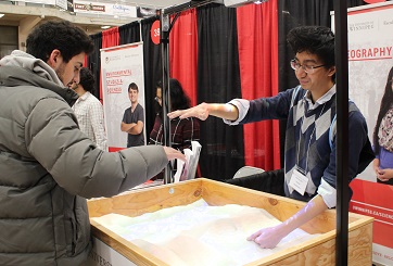
UWinnipeg student Ian Batista demonstrates how to make rain within an AR virtual sandbox.
Ian Batista is a third-year Bachelor of Education student. He had the opportunity to experiment with the sandbox as a volunteer at UWinnipeg’s recent Open House, demonstrating how the environment could be impacted by creating, demolishing, and recreating mountains, rivers, and lakes in the sand.
“What I like most about this sandbox is that it’s hands-on and fun to use,” he said. “It can be used in intro courses to explain hard-to-grasp ideas like elevation and topography. Or it can be used to explain higher level concepts, model real-life spaces, and alter them.”
While interacting with the AR virtual sandbox can feel like play, it’s actually a high-tech learning tool designed to help students understand basic earth processes and visualize how these processes are changed during natural events such as floods and rising sea levels or man-made events such as construction of a highway or dam.
“Some students find it challenging to visualize three dimensions on a sheet map,” said Storie. “This allows them to understand that when you see little dips in the contour line that means there’s a slope. It helps build the image of what’s going on, providing a vivid visual to tell the future story.”
Storie sees the AR sandbox as a tool to translate technical, scientific language into well-rounded knowledge that inspires creativity.
“We don’t know what jobs people are going to be doing in 10 years, so students need to be educated in a way that allows them to adapt,” he said. “You get enough people around the sandbox you could probably build a castle.”


