The Hudson Bay Railway provides a critical lifeline to Northern Manitoba, one that is severely impacted by global warming.
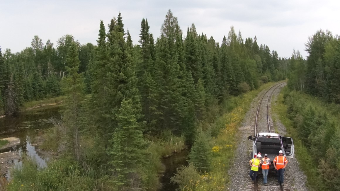
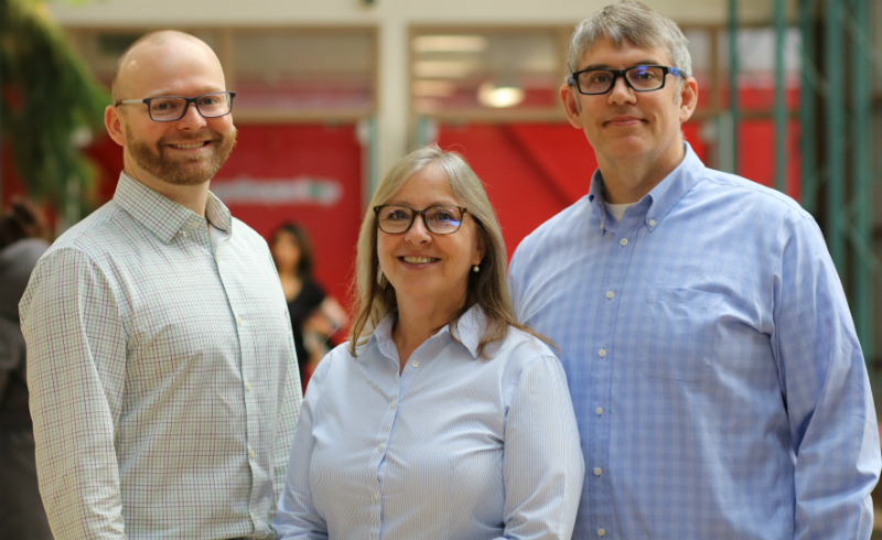
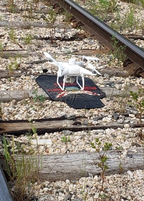
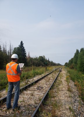
With this in mind, Dr. Christopher Henry, Dr. Christopher Storie, and Dr. Joni Storie are exploring research for Arctic Gateway Group and working with Grant Barkman at DecisionWorks to develop innovative monitoring software to mitigate hydrological impacts on the Hudson Bay Railroad. Over the next two years, they will use satellite data for monitoring hydrological outflow to develop an early warning system. At the same time, they are using high-resolution drone imagery to map the impact of hydrological events on the railway.
There are Indigenous communities along the rail line whose only lifeline is that rail linkage, so it is a critical piece of Manitoba infrastructure.
Dr. Christopher Storie
“We are developing technologies that they can integrate into their operations to monitor their lines on a daily basis. This will save them money and improve safety, which is at the end of the day one of the most important things,” said Henry. “We are hoping that once this solution is up and running it can also be used for other northern rail lines across Canada.”
Barkman says the rail line provides northern communities with vital access to transportation and resources.
“The majority of our work is in remote, northern regions of our country. Historically, and still largely true today, most northern regions are predominantly represented by Indigenous communities. As an extension, virtually all of the work we are doing directly and indirectly benefits northern, Indigenous communities and we are proud to partner with them to create sustainable skills development wherever possible,” he said.
Working with the University of Winnipeg research team gives DecisionWorks access to cutting-edge research and innovative solutions to solve complex problems for their clients.
“Big questions require big answers,” said Barkman. “In order for a smaller, commercial consultancy such as ours to compete against larger organizations, collaboration is absolutely essential. Our partnership with The University of Winnipeg allows us to deliver a high-quality service to our clients, helping them grow, which, in turn, helps create economic activity, new and better jobs.”
Using drone and satellite data to protect railway
A $225,000 Research Manitoba Innovation Proof-of-Concept Grant allows the research team to examine high-resolution drone imagery, track geometry, and mapping of localized hydrologic impacts on the rail line. They are able to take what they are learning from this data and apply it to larger scale satellite data being collected in a concurrent project funded by a $105,000 Mitacs Accelerate Grant.
“With a drone, you can image an area the size of Polo Park mall at high resolution which provides very fine detail of what’s going on. The satellites can’t do it at that level, but with a couple of satellite images we see all of Northern Manitoba,” said Dr. Christopher Storie. “If satellite imagery detects something, we can deploy a high-resolution drone scan to see what’s going on. Or if the drone picks up something we can target a satellite analysis to look at the larger geographic area.”
By collecting both close-up and big picture data, they are able to provide Arctic Gateway Group (owners of the Hudson Bay Railway) with vital resources to protect the rail line from flooding.
“The ultimate goal is to provide this kind of information on an ongoing basis that they can use to ensure the rail line never gets knocked out of commission again,” said Dr. Christopher Storie. “We’d like to give them as early a warning as possible so that a crew can get out and open up a section of beaver dam to keep that water moving or check a culvert before it backs up, or look at infrastructure upgrading, such as putting in more culverts and creating different hydrological structures that protect vulnerable parts of the track.”
As an Associate Professor in the Department of Geography, Dr. Christopher Storie has hosted many summer field schools in Churchill and seen firsthand how important the rail line is.
“If our research can in any way minimize the amount of rail shut down, or, in a perfect world help ensure the rail line is open 24 hours a day, then we’ve ensured the lifeline to our northern communities is there,” he said.
Developing advanced skills
Two master’s students are working with them on this project, developing vital skills to become the next generation of Highly Qualified Personnel (HQP) in Manitoba.
Using machine learning and mapping technologies, the students will work with the research team to better understand the permafrost region.
Master of Science in Applied Computer Science student Mikhail Sokolov will be examining data related to detecting and identifying bodies of water in hopes of predicting how water moves toward and impacts the rail lines.
“This project gives me a chance to explore new methods of data analysis and preprocessing, develop skills for out-of-the-box problem-solving and non-standard solutions,” he said. “This opportunity to establish connections with UWinnipeg professors, business managers, and Hudson Bay Railway representatives allows me to expand my social network and will help me find a job faster after graduation.”
Master in Environmental and Social Change student Ryan Shirtliffe will be analysing satellite data to develop thresholds based on previous research, applying this data to what is discovered within the permafrost region.
“These students will have a high level of skill that is desirable by government agencies and private consulting companies,” said Dr. Joni Storie. “We’re teaching them what you need to do to solve complex problems because doing things the old way is not effective anymore.”
Arctic climate poses unique challenges
While they are, to a certain extent, able to build on previous research monitoring surface water in Southern Manitoba, Dr. Joni Storie says the northern climate creates unique challenges.
“We are growing our expertise while building on work we have done before, so we’ve got a foundation there but it’s not directly translatable because Northern Manitoba is a permafrost region and we don’t always know where surface water is going to go because it changes year to year,” she said.
The research team looks at things like surface water size, precipitation, beaver dams, hydro generation, and climate change, comparing data from past events to determine the level of risk.
“If a body of water reaches a certain size it will go into an early warning system,” she said. “That’s the type of information we would share with the Arctic Gateway Group to let them know that this is one of those events in proximity of the rail lines that they should be aware of, because it could lead to flooding of the rail line.”
She says the knowledge they gain through this research will contribute to a bigger picture understanding that will impact development in the entire Arctic region. She has led research into how Canada, Greenland, Iceland, Norway, Sweden, Finland, Russia, and the United States use satellite data to understand how the Arctic is impacted by climate change.
“As more rail lines, pipelines, and roads are developed in the Arctic, they will need help to monitor and mitigate any challenges they face in that environment,” she said.

